The Nasu mountain range is located at the southern end of the Nasu volcanic belt. It
was formed by volcanic activity that began 500,000 years ago with the eruption of Mt.
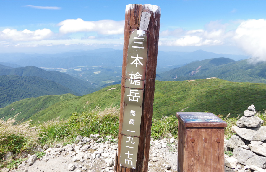
Kashiasahi (1,835 m). Some 200,000 years later, Mt. Sanbonyari (1,917 m) erupted,
and the peaks of Mt. Futamata (1,554 m), Mt. Asahi (1,896 m), and Mt. Minamigassan
(1,776 m) were formed roughly 100,000 years after that. A U-shaped caldera—a large
cauldron-like hollow that forms shortly after the emptying of a magma chamber in a
volcanic eruption—developed between Mt. Asahi and Mt. Minamigassan between
40,000 and 30,000 years ago. Eruptions around 16,000 years ago created Mt. Chausu
(1,915 m) in this caldera.
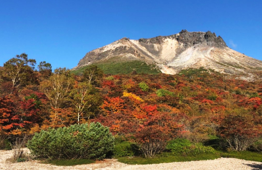
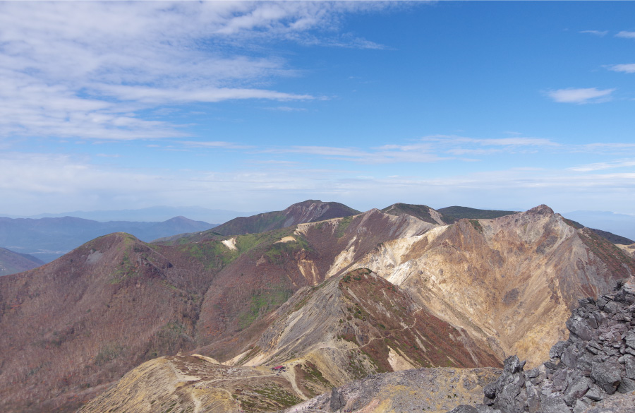
Today, Mt. Chausu is the only active volcano in the range. Its current shape is
startlingly recent: the lava dome at its peak was created by a series of eruptions
between 1408 and 1410. Lava domes are created when lava is especially viscous
(thick) and does not flow very far before cooling. The andesite that flowed from the
mouth of Mt. Chausu quickly hardened into the barren summit seen today.
There are fumaroles (volcanic vents) on the western face of Mt. Chausu near the peak
and at the southern foot near the Sesshō-seki (“Killing Stone”). They emit sulfurous
gases at extremely high temperatures of around 90ºC. The area of fissures near the
peak is known as Mugen Jigoku, or “Infinite Hell.” As the name suggests, nothing
grows in this rocky terrain, where the smell of sulfur hangs heavily in the air, clouds
of vapor obscure the cliffside, and the rocks are tinted yellow by crystallized sulfur.
More than 150 hot springs have been found in the Nasu area, evidence of ongoing
volcanic activity. Most of these are heated by the magma that lies beneath Mt.
Chausu.
Although the mountain is still an active volcano, its activity level is closely
monitored, and visitors can safely hike to its peak. For easy access, the Nasu
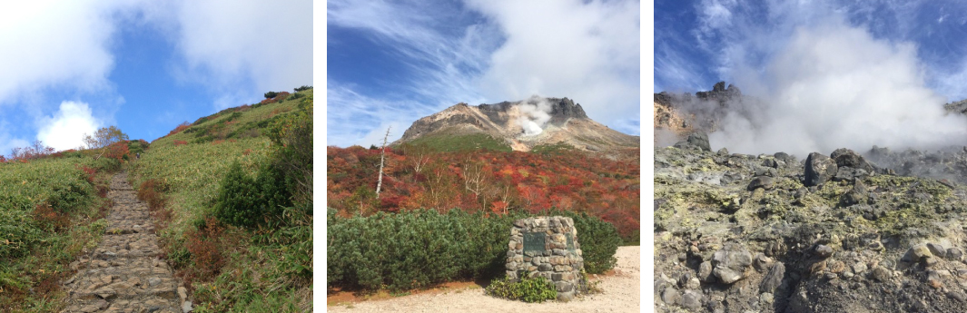
Ropeway takes passengers to an altitude of 1,680 meters. A trail leads west from the
ropeway station, and it takes about 50 minutes to reach the summit.
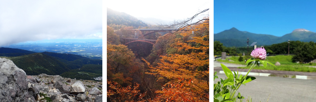
One of the joys of hiking in Nasu-Kashi is the visceral sense of geological transformation that visitors feel when looking out over the many different aspects of the local mountain vistas.
At the base of the mountain, visitors can enjoy flowers and forests, while atop Mt. Chausu, one can still experience plumes of smoke rising from the volcano.
Higher up the rugged mountains, the landscape gives way to shrubs and grassland, offering the chance to enjoy the different aspects of the Nasu-Kashi area.
Nasu Mountain Range
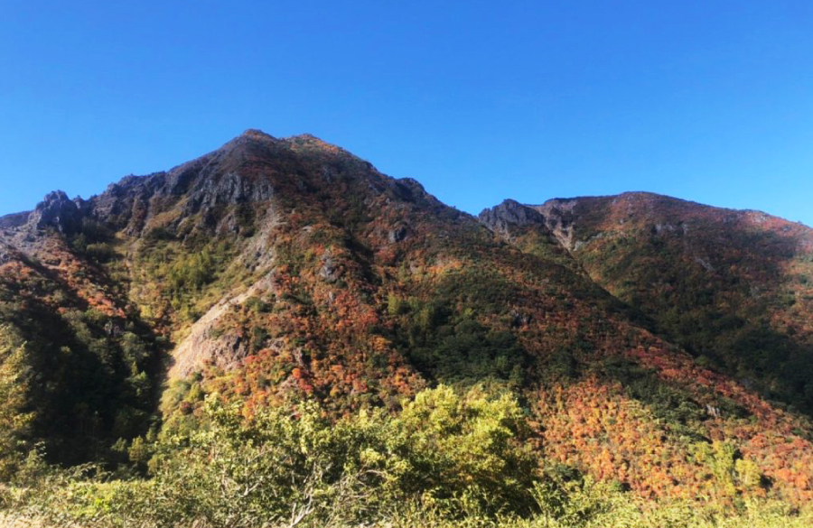
Famous for the beauty of its ridge-lines, the Nasu mountain range is a cluster of volcanoes centered around Nasu Go-hou, (Nasu Five Peaks", sometimes collectively referred to as Mt. Nasu).
The principal peaks of Nasu Go-hou, which form the spine of the Nasu mountain range, are Mt. Chausu (1,915 m), Mt. Asahi (1,896 m), Mt. Sanbonyari (1,917 m), Mt. Minamigassan (1,776 m) and Mt. Kuro-oya (1,589 m).
The Nasu mountain range is located at the southern end of the Nasu volcanic belt, which was formed by volcanic activity that began with the eruption of Mt. Kashiasahi (1,835 m) 500,000 years ago.
Eruptions began at Mt. Sanbonyari around 300,000 years ago, and the peaks of Mt. Futamata (1,554 m), Mt. Asahi, and Mt. Minamigassan were formed between 200,000 and 100,000 years ago.
Eruptions in the caldera formed between Mt. Asahi and Mt. Minamigassan began around 16,000 years ago, where repeated eruptive activity led to the formation of the present Mt. Chausu.
Mount Chausu (Chausu-dake)
Mt. Chausu erupted violently over the two years from 1408 to 1410. This eruption formed the hardened andesite dome of the mountain’s present summit.
This eruption reputedly claimed the lives of over 180 victims.
Although the most recent eruption at Mt. Chausu took place in 1881, volcanic activity continues today.
The field of fumaroles (volcanic fissures) atop Mt. Chausu, which emit sulfurous gases as hot as 90 degrees Celsius, is popularly known as Mugen Jigoku ("Infinite Hell")
As suggested by its name, nothing grows on this barren and rocky land, where powerful sulfurous odors and clouds of vapor hang in the air.
Visitors to this area will see yellow sulfur crystals.
The summit of Mt. Chausu can be reached using either the mountain hiking route or the Nasu Ropeway.
Mt. Asahi
Mt. Sanbonyari
Nasukogen
Nasukogen is a mountain highland situated an elevation of about 1,000 m, and typically refers to mountainous area on the northernmost side of the Nasunogahara alluvial fan, centered on Mt. Chausu.
(There seem to be slight differences of opinion, even between experts and otherwise knowledgeable parties, about the boundaries of the Nasunogahara area, which is delimited by the intricate tangle of several rivers – the Houki-gawa, Kuma-gawa, Sabi-gawa, and Naka-gawa – into an alluvial fan.)
Home to the Nasu Imperial Villa, a holiday home for the Emperor and Imperial Family, the area has also become popular with the general public as a summer getaway and hot spring spa, and has developed further as a highland resort where visitors can enjoy the seasonal highlights and lush panoramas of the natural mountain landscape.
Guide to hiking trails in the area
Nasu Nature Study Path
This trail links the hot springs of Yahata Onsen, Benten Onsen and Ōmaru Onsen.
Despite its several ascents and descents, we recommend the climbing trail.
Watch for the stunning panoramic vista that opens up when you emerge from the azalea tunnel (in last
spring) and Mt. Chausu leaps into view. The area is also a hidden paradise for azaleas.
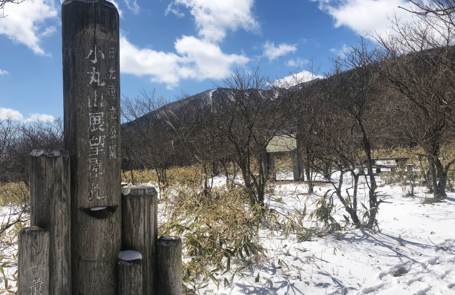
Komaruyama park
This pleasant clearing affords views out over Mt. Chausu and the Kanto Plain.
Visitors can take a break on a bench or enjoy a picnic lunch while drinking in the scenery.
It’s also a hidden spot for nighttime views, so the park can be enjoyed in the morning, daytime, and evening.
Why not stop for a rest when you are out for a drive?
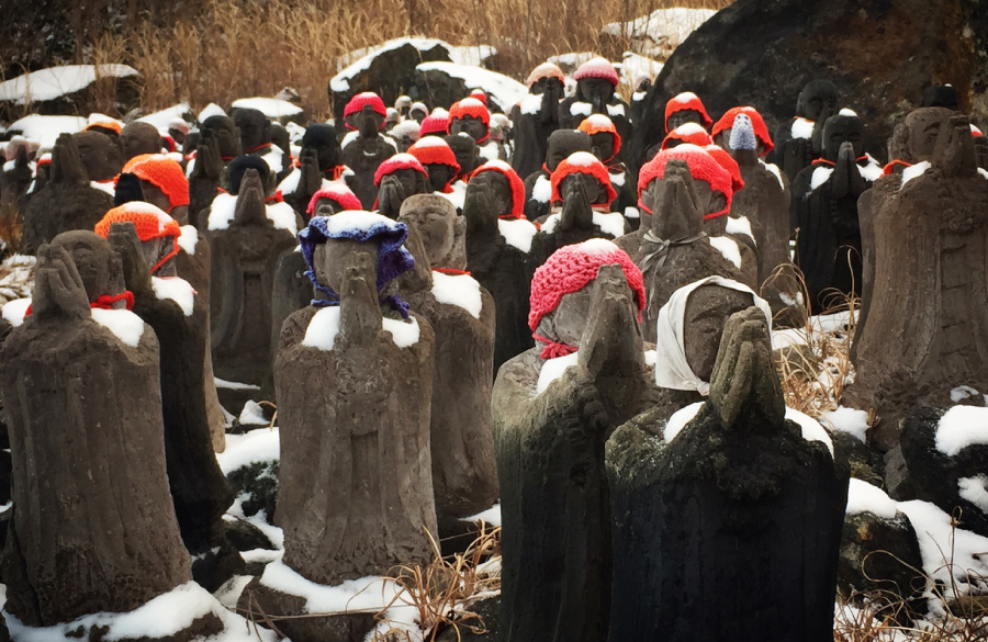
Sesshō-seki ("Killing Stone") and Observation Point
Seen in profile up close, the Sesshō-seki ("Killing Stone") has a powerful ambiance.
The observation point looks out over the hot spring spa town of Yumoto Onsen.
Hikers on this trail are likely to encounter wild birds and find soothing solace in the gentle babbling of the nearby river.
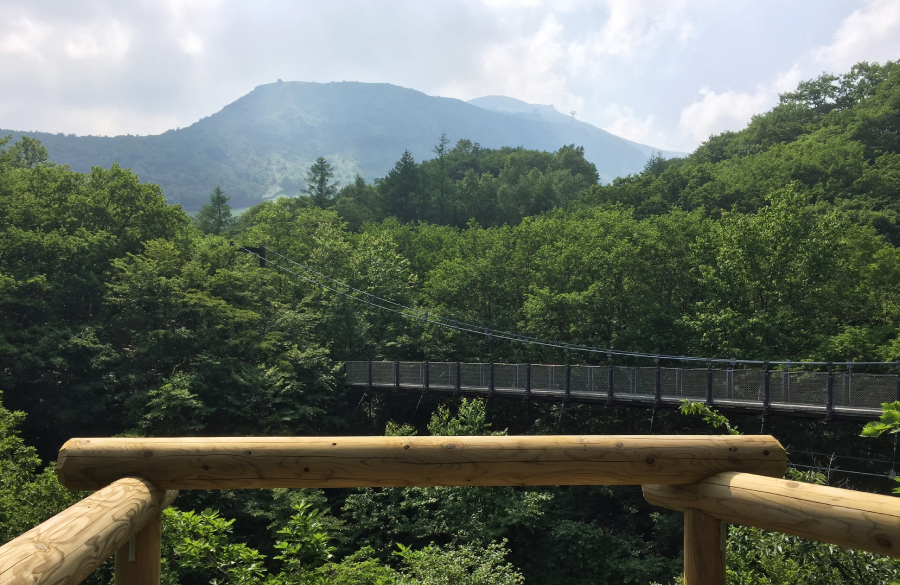
You can also access the Tsutsuji Suspension Bridge (Tsutsuji Tsuribashi) from the mid-point of the trail.
Heal your mind with a walk in the woods and soothe your body in the hot springs. A two-for-one special!
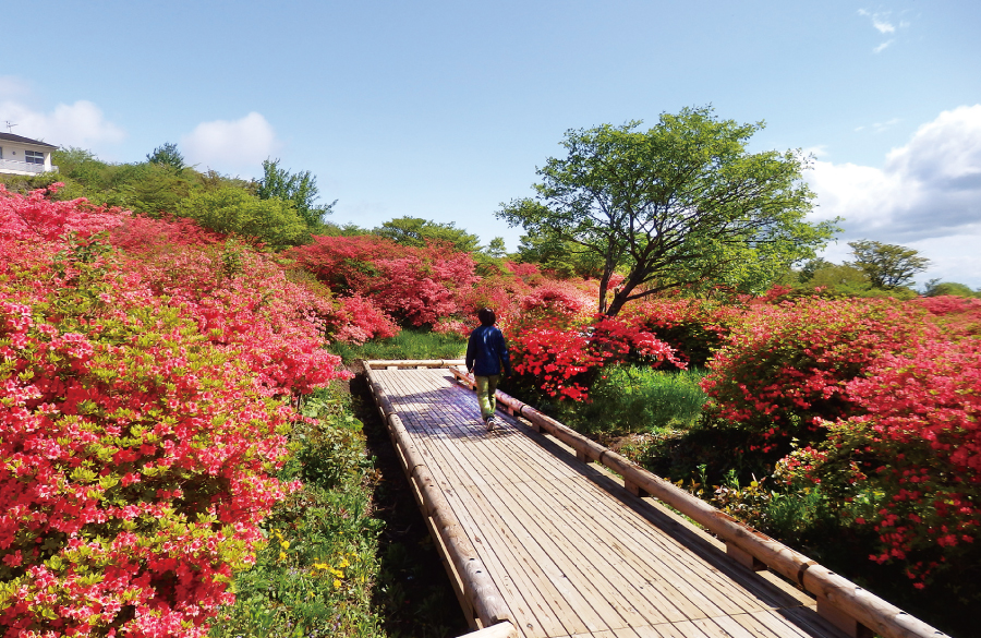
Yahata Azalea Park
In late spring, when the azaleas are in full bloom, the entire area is carpeted in pink.
This trail is well equipped with wooden boardwalks, making it accessible even for wheelchair users.
This trail offers a variety of seasonal attractions, including the autumn colors of the azalea and maple leaves and walking along the snow-covered boardwalks in winter.
The Nasu-Kashi area is home to a diverse ecosystem.
A characteristic feature of the Nasu-Kashi area is that visitors will encounter plants native to both the Sea of Japan coast and Pacific coast.
For example, why not try to identify genuine specimens while walking through the forest? Also pay close attention to the bamboo grass and large trees like the Mongolian oak and beech.
If you listen closely, you will hear the songs of various birds, and if you keep a close eye on the trees and ground, you might find spoor such as claw marks left by bears, deer tracks, and mysterious droppings.
What a fun way to enjoy the forest!


 Highlighting the beautiful seasonal charms of the Nasu Mountain Range, with suggestions on activities to enjoy in the area
 Featuring the local culture and hot springs with over 1,400 years of history, as well as the legend of the Sesshō-seki, or “Killing Stone”
 Nasukogen enjoys a deep relationship with the Imperial Family, and is home to an Imperial Villa that serves as their summer retreat.